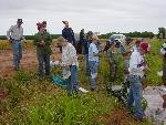
Bluff
Creek Complex Field School
May
24-26, 2004 site 14HP5
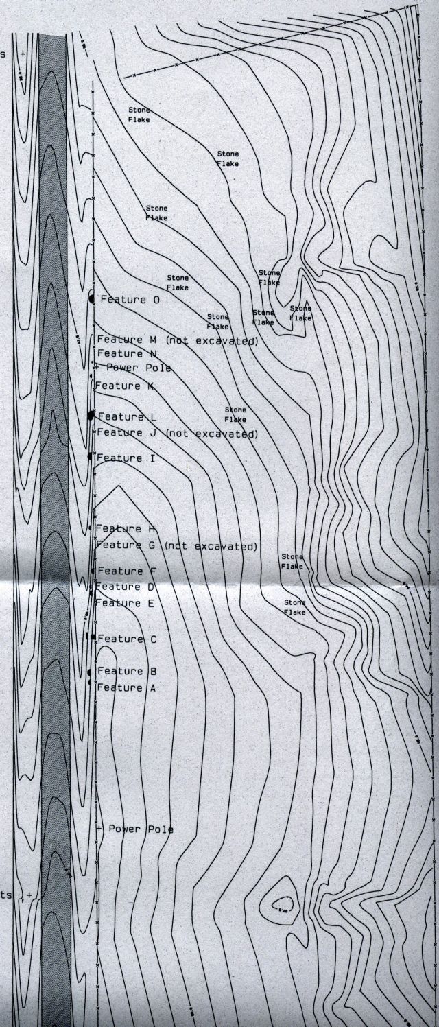
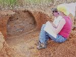
From the lithic evidence this was a large or well used site, based on the stip we dug on the east ditch of the county road in May of 2004 and returned in 2005 to do the 'west ditch'. The carbon 14 dates at 800+/- 40 AD tell us it was early for a Horticulture / Bison hunter's 'camp' in the plains. The site situated West of Wildcat(?)creek and about .25 miles South of Bluff creek on a low ridge has a viewscape that extends to the Northwest to the town of Anthony Kansas about 7 miles (and Bison grazing to the North and West could have been observed). You can see buildings in Anthony from the site.
topcon.jpg
There is no view to the South. The lithic material ran out before we got to the top of the low ridge to the South of 14HP5 on the road cut.
bluffsite.htm
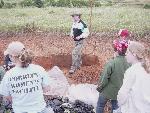
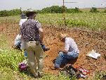
We found that some of the features like 405L, etc were left open and soil eroded into them from profiles taken indicating they had been 'abandoned' before final filling. The 14HP4 site was 'north facing'. Not a good thing in the winter in Kansas today. Now The climate in 800 AD in the area was the beginning of a Western American drought (including mesoamerica). Droughts could cause mild winters Local's say that Bluff Creek always flows. So a supply of fresh water is "always" available.
http://www.nyas.org/events/eventDetail.asp?eventID=4667&date=10/18/2005%206:00:00%20PM
It was dry based on global data. Were the winters mild? So they may have stayed
here in the Winter. The Bison may have ranged close to the creek for the water.
The site would protect 'residents' from the south wind in the summer. I would be
interested to know how much 'shading' from the summer wind the site has (if any).
It may be the site was chosen only for the 'viewscape'.
Points:
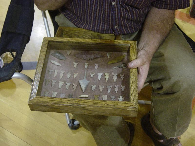
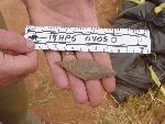
The point found 4/2006 in heavy float material from 14HP5 is typical of the points
shown from the land owners collection from Bluff Creek:
bluff96.jpg
The hafting is medium width. There is similarity between the hafting width on most
of the points suggesting a 'standard' shaft or foreshaft width. Whether the points
were for shafted spears or arrows maybe a question due to the antiquity.
Larger 'points' were knives or spears from the land owners collection.
(4/19/2006 picture to be added to the web site of the new find)
I would also be interested in where the 'Black Dog' trail crossed the landscape in Harper county. If it was to the North the 14HP5 site would also have given the people a view of those using a trail. The Black Dog trail comes later if the iron in Ohio mounds from Kansas is a marker for the use of some of these old indian trials. The Bluff Creek people obtaining the Florance A chert from east of Ark City may have been among the first to 'ford' the Arkansas river at the Ford south of Oxford Kansas.
It would be interesting to see if the Zeba site had similar artifacts. Even in 1947 Zeba was not thought to be a 'wichita' site. Dr. B suggested Zeba was Pratt complex.
Article: Here North American Drought, 800 AD to the Present: OceanAtmospheric Interaction, Climate Change, and Hydrology of the American West Speaker: Richard Seager, Lamont-Doherty Earth Observatory, The Earth Institute at Columbia University; Introductory Remarks: Michael Purdy, Director, Lamont-Doherty Earth Observatory Sponsored by: Environmental Sciences Section and Atmospheric Sciences & Geology Section The New York Academy of Sciences is cosponsoring this event with The Earth Institute at Columbia University. Droughts that last several years are recurring features of the American West and are costly natural disasters with impacts on agriculture, water resources, forest fires, river flows, and fisheries. The Dust Bowl drought of the 1930s was a searing development in American social, economic, and political history, one that was memorialized in some great works of American culture.
In recent years meteorologists and oceanographers have begun to unravel the causes of
these persistent droughts, placing the blame on subtle but persistent changes in tropical
Pacific sea surface temperatures (SSTs) that arise as part of the El NinoSouthern
Oscillation phenomena of coupled atmosphereocean interaction. During periods of
persistently cool waters in the equatorial Pacific Ocean, atmospheric temperatures
and circulation is changed in a manner that causes downward motion over North America,
which effectively suppresses precipitation. Persistent droughts over North America
are not isolated events but arise as part of a global reorganization of the Earth's
rain belts. When drought strikes the American West it also strikes southern South
America, parts of Europe, and central Asia while tropical land masses get wetter.
Even though the droughts that struck the American West in the nineteenth and twentieth
centuries had devastating consequenceson Native Americans, settlers and bison in the
mid-nineteenth century, and on small farmers in the Dust Bowlthese droughts were
modest compared to droughts that occurred during the medieval period. At that time
the American West experienced droughts of the same severity with alarming regularity
and for several hundred years. Once more the evidence tips the tropical Pacific Ocean
as the cause, with SSTs there altering as a response to a period of relatively high
solar irradiance and reduced volcanism. If so, then the medieval megadroughts in the
West have important implications for the hydrological future of the West in an
anthropogenically induced greenhouse world. These aspects of the hydrological history
of the American West 'will be discussed'
using analyses of observations, climate model simulations beginning in 1856, and
analyses of long tree-ring records.
Richard Seager is a senior research scientist at Lamont-Doherty Earth Observatory,
The Earth Institute at Columbia University. He was educated in England until moving
to New York in 1983. He gained his Ph.D. from Columbia in 1990. His work involves
how coupling between the atmosphere and ocean causes climate variability and change
around the world on timescales ranging from seasons to glacialinterglacial cycles.
Michael Purdy is Director of Columbia University's Lamont-Doherty Earth Observatory.
He previously worked at the Woods Hole Oceanographic Institution (WHOI) in
Massachusetts, and the Division of Ocean Sciences at the National Science Foundation.
 Some artifacts found and shared |
 Views of the Bluff Creek Site |
 Feature Details |
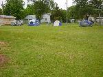 Camp pictures |
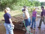 Wet Screening |
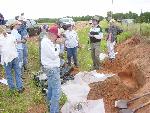
May 2004 WSU Archeology
Field Team Pictures
Anthony Republican 5/26/04 newspaper article with pictures of the author Jerry Keene
- updated on April 20, 2006
- email norm@normconley.com
InfoCog Travel:
Your passport to vacation tips and travel guide information.
InfoCog: Online business resource for
starting an internet company.
MyAisha: Belly Dance Search Engine and free
website promotion for belly dancers.
Raks Araby Belly Dance Troupe Wichita,
KS.